The College of Hospitality and Institutional Management (CHIM) celebrates a remarkable 27-year journey of excellence, resilience, and transformative leadership. CHIM@27 is more than just a milestone—it is a living testament to a legacy of passion, purpose, and progress in the fields of hospitality, tourism, and institutional management. CHIM has shaped globally competitive professionals and nurtured leaders who drive meaningful change across industries for over two decades. This year’s celebration—T.A.R.A.L.E.T.S. CHIM@27, Trailblazing and Reaffirming Aspirations in Leadership, Excellence, Team Spirit, and Sustainability—is both a call to action and a tribute, reminding us of how far we’ve come and the boundless potential ahead.
The video celebrates 27 years of the College of Hospitality and Institutional Management, emphasizing leadership, excellence, team spirit, and sustainability.
From winning national competitions to steering the largest organizations in the country, CHIM doesn’t just participate—we lead. Our faculty burns the midnight oil, crafting lessons that ignite minds, while our students command the spotlight, turning stages into their platform. And our graduates? They’re out there rewriting different stories of success. This isn’t just an achievement—it’s the CHIM DNA in action. We don’t just meet standards—we set them. We don’t just join the conversation—we own it. Year after year, batch after batch, we prove that when you’re CHIM-trained, excellence isn’t an option… It’s the only way forward.” At CHIM Quezon City, our faculty members continually strive to reach higher, pursuing doctoral degrees and conducting groundbreaking research that pushes the boundaries. Meanwhile, our students rise to new challenges, making waves in their fields and proving that CHIM excellence isn’t just taught—it’s lived. Together, we’re not just building careers but shaping the future of hospitality and institutional management in the Philippines and beyond.
In every endeavor, we embody the OLFU mantra: “Improving man as man.” As we celebrate the CHIM’s 27 years of leadership and innovation, we reaffirm our mission to inspire, elevate, and transform—not just as professionals, but as catalysts for a better future.
Symbolizing the Filipino Spirit: The Jeepney as a Cultural Icon
The official logo for CHIM@27 features a reimagined Philippine jeepney, seamlessly tied to this year’s theme. More than just a vehicle, the jeepney is a national treasure—a post-World War II innovation born out of Filipino ingenuity. Originally, these were U.S. military jeeps left behind after the war; they were transformed by Filipino hands into vibrant, moving works of art that today serve as the backbone of public transportation across the country. At the heart of this celebration is a symbol deeply rooted in Filipino culture—the jeepney, which represents creativity, resilience, and community.
Symbolizing the Filipino Spirit: The Jeepney as a Cultural Icon
The official logo for CHIM@27 features a reimagined Philippine jeepney, seamlessly tied to this year’s theme. More than just a vehicle, the jeepney is a national treasure—a post-World War II innovation born out of Filipino ingenuity. Originally, these are from the U.S. military jeeps left behind after the war, they were transformed by Filipino hands into vibrant, moving works of art that today serve as a backbone of public transportation across the country. At the heart of this celebration is a symbol deeply rooted in Filipino culture—the jeepney, which represents creativity, resilience, and community.
TARALETS! A Celebration of Excellence and Purpose.
In Filipino colloquialism, “TARALETS” means “Let’s go!”—an invitation to move, to act, to explore what lies ahead. As CHIM celebrates its 27th year, we are reminded not just of how far we’ve come but of how much more we can achieve. Like the ever-evolving hospitality and tourism industry, we too must continue to innovate, connect, and rise to new challenges with courage and compassion.
So let us ride on, proud and empowered. With the spirit of the jeepney guiding our path and the TARALETS’ momentum fueling our mission, we look to the horizon with confidence and conviction. With our vibrant heritage as our foundation and our aspirations lighting the path forward, CHIM@27 is a celebration of our shared journey—one fueled by leadership, excellence, team spirit, and sustainability.
Abundance. Legacy. Vision.
We do not just look back at our achievements; we charge forward with the same determination that has defined us for nearly three decades.
Together we’re strong; together we’re one. Let’s go forward hand in hand. TARALETS, CHIM Nation!
Looking back, the way EPICurean Fair has transformed to the next level.
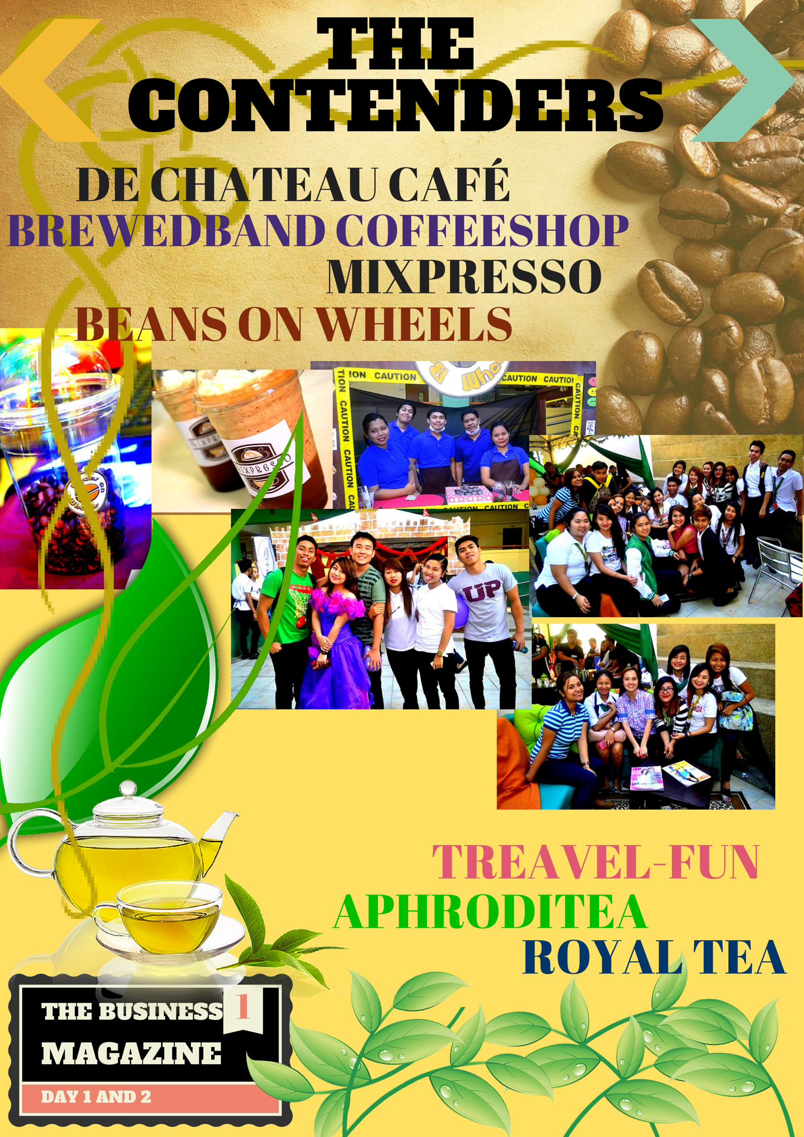
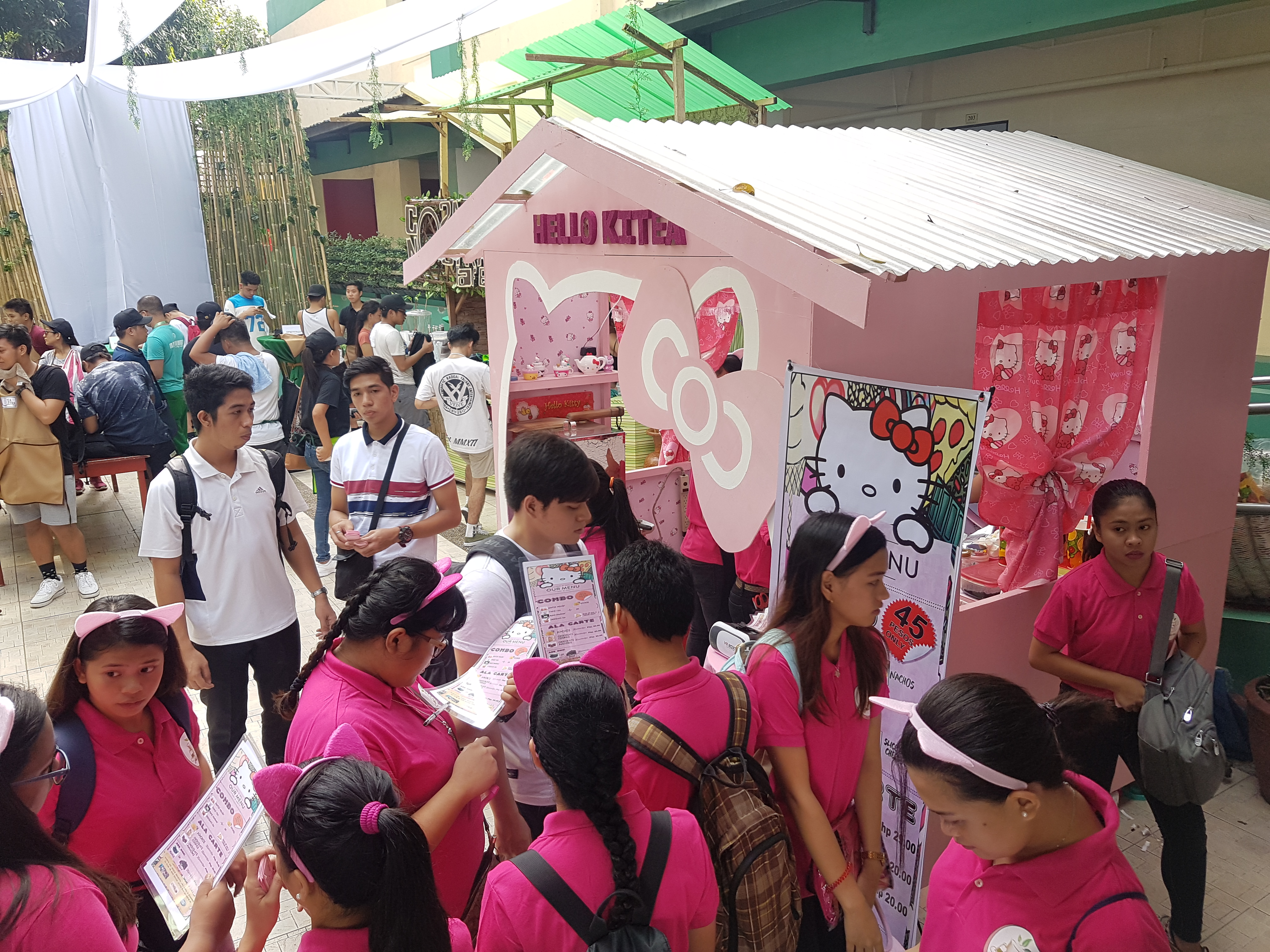
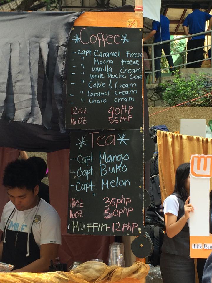
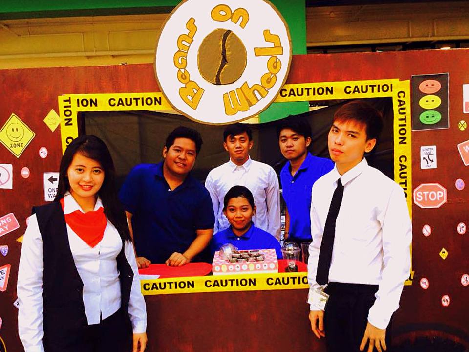
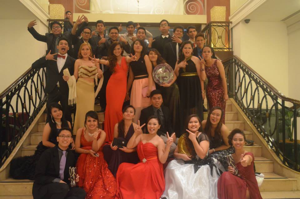
The Sailor Arabica won the “Overall Leader” of the 1st semester season of EPICurean Fair 2017. In photo (from left to right) Rachel Subando (Organizer, EPICurean), Josephus Cayabyab (Chairman, EPICurean Fair), Jason Cama (judge), Terence Berjuega (judge), Engel Joe Estaris (judge), Shiela Garrido (Organizer, EPICurean Fair), Enrique Perez (Co-Chairman, EPICurean Fair) The Hello Kitty Cafe participated in the 1st semester season of EPICurean Fair 2017UniversiTEA won the overall Leader in the 2nd semester season of EPICurean Fair 2016
The situation: Both of them are male bisexual Pa-fall si student, na na-fall naman si barista
Naging close dahil sa isang school organization.
Charming si student leader while mukang kind naman si barista
Classic storry ito ng more than a friend but less than a lover.
Typical story ng somewhat platonic relationship
Medyo malapit sa dare na “bawal ma fall”
Mr. Barista want to know certain whys towards Mr. Student Leader:
Baket after all happy moments with him and all the secrets being opened just for him, why he keeps me hanging?
Baket parang ang bilis nya mag-give-up knowing na wala pa naman kaming nasisimulan? Ihahashtag ko dito si #rootcause
Baket mo pina-feel mo sa akin na when we are together automatically I let my guard down and show you my real me, my real colors? And now parang ang-UNFAIR?
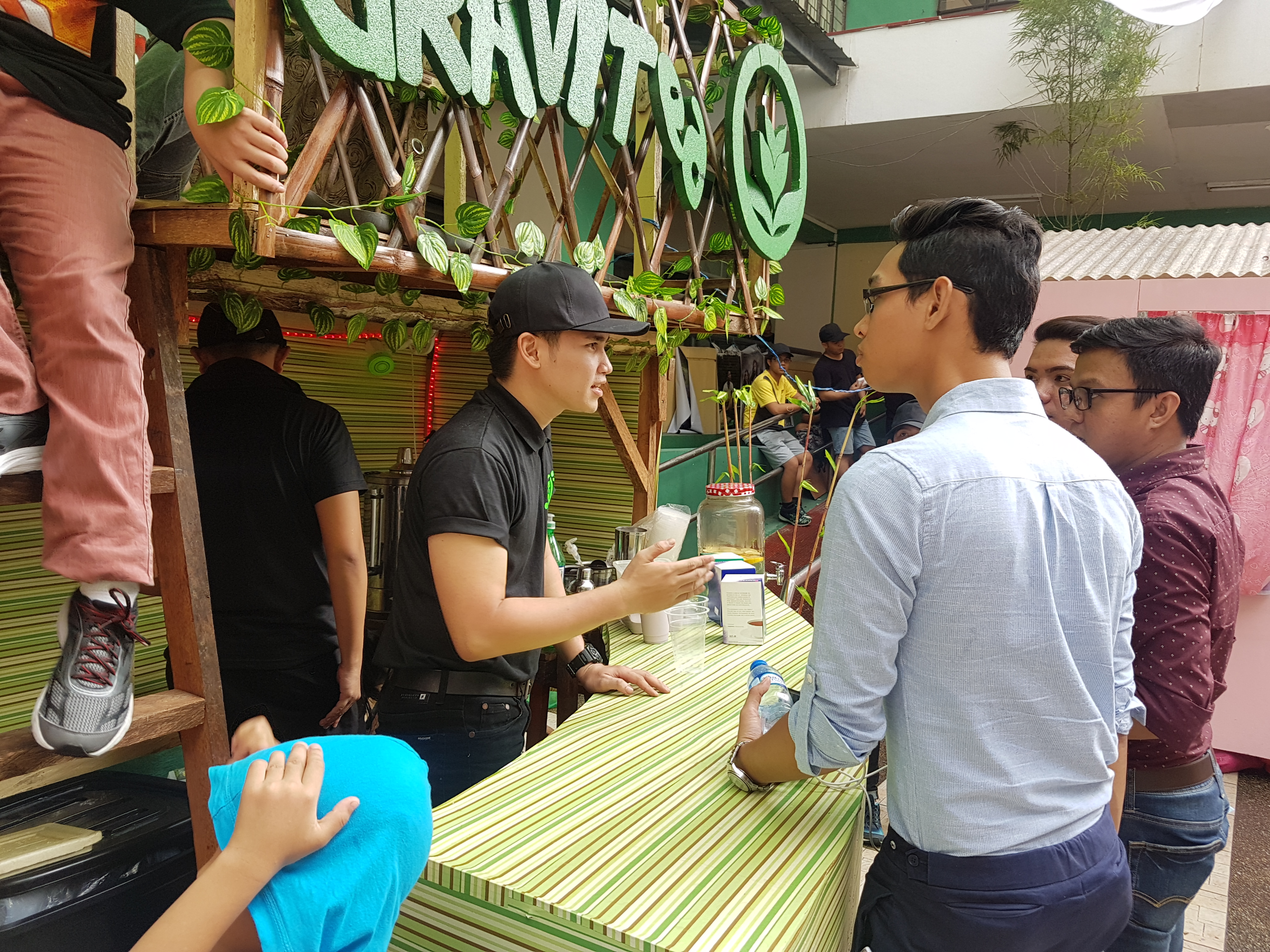
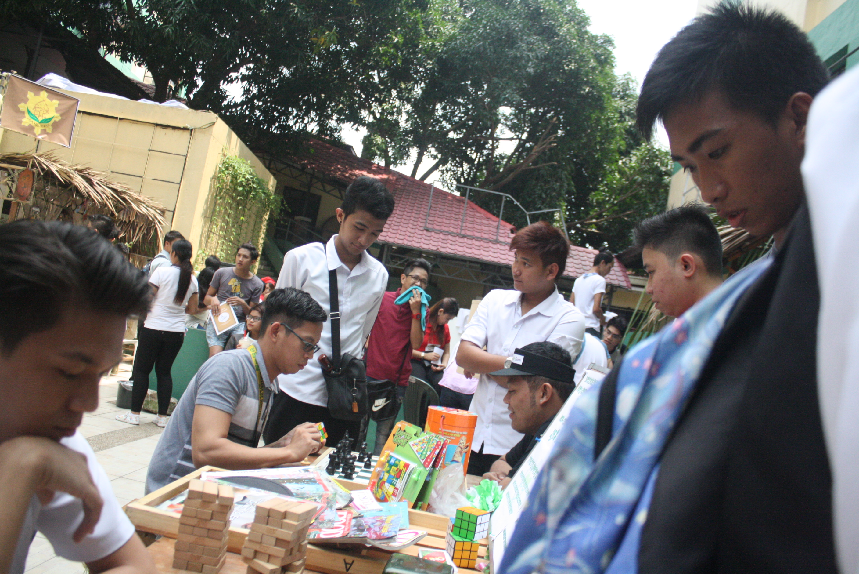
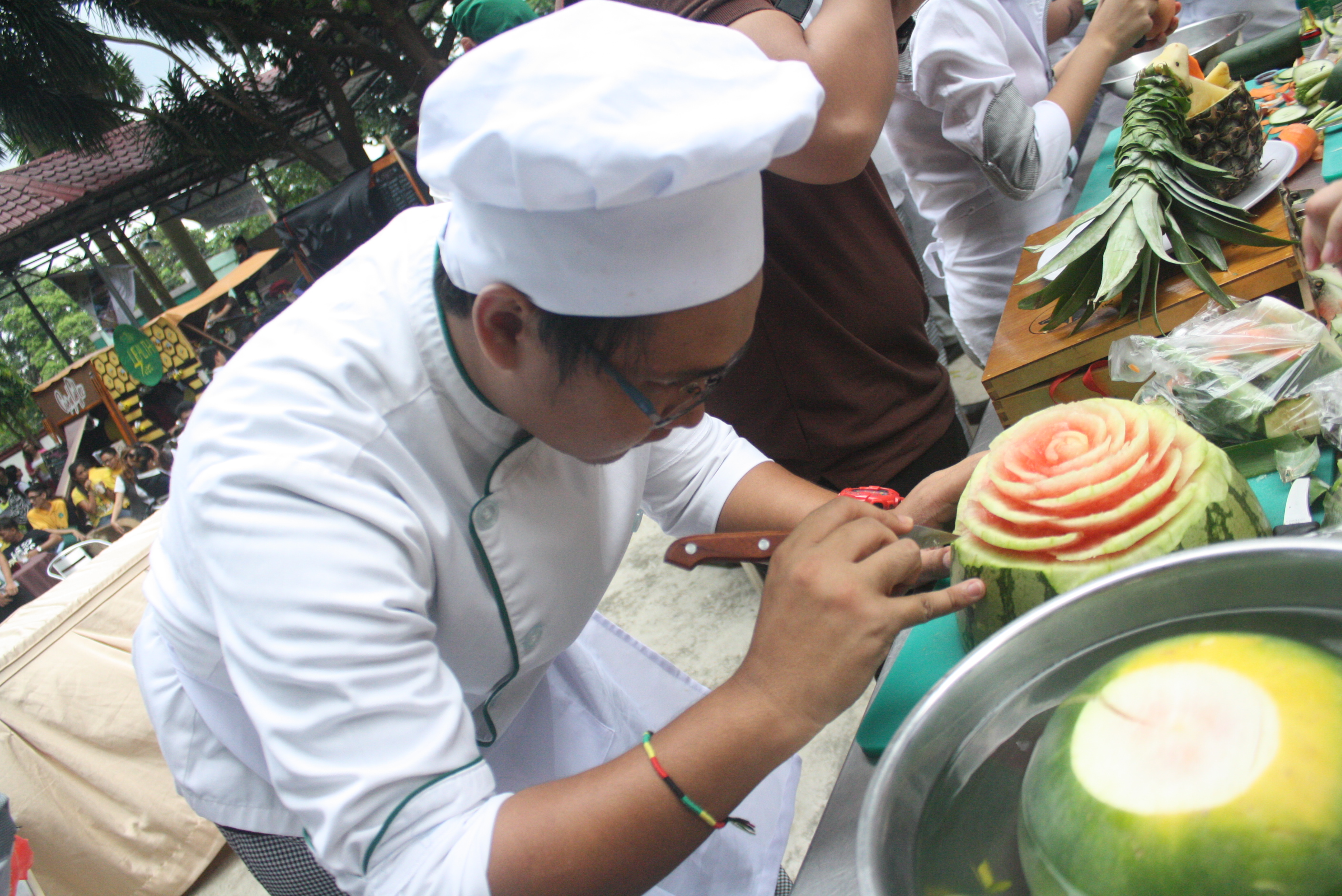
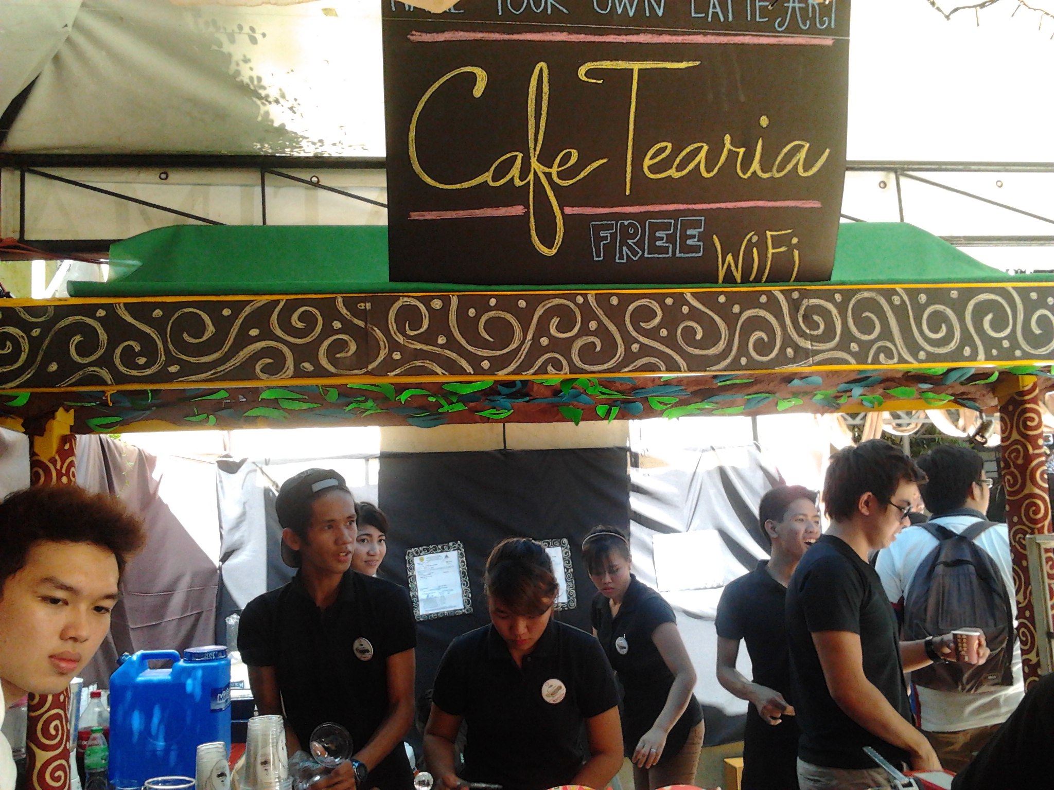
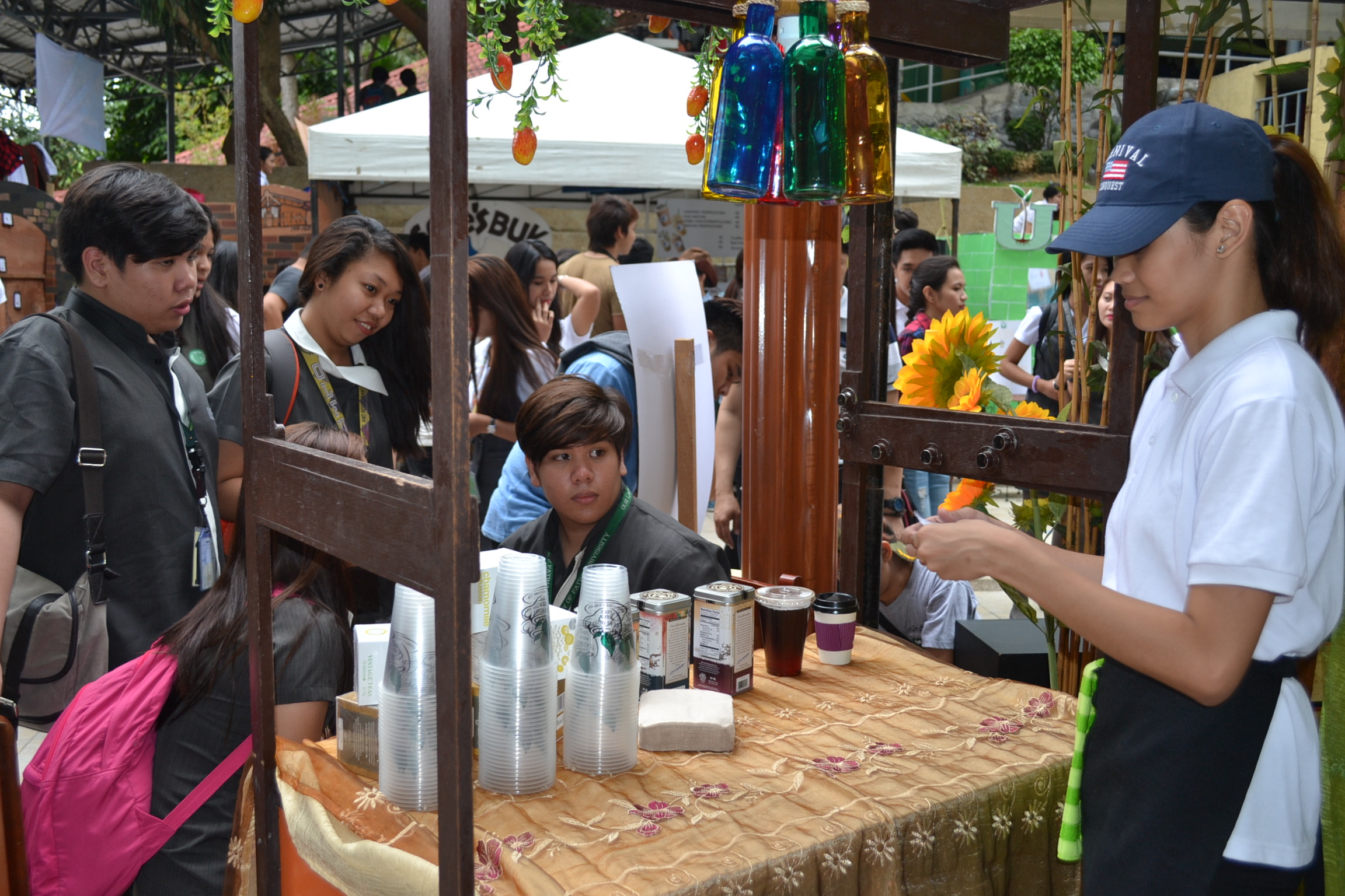
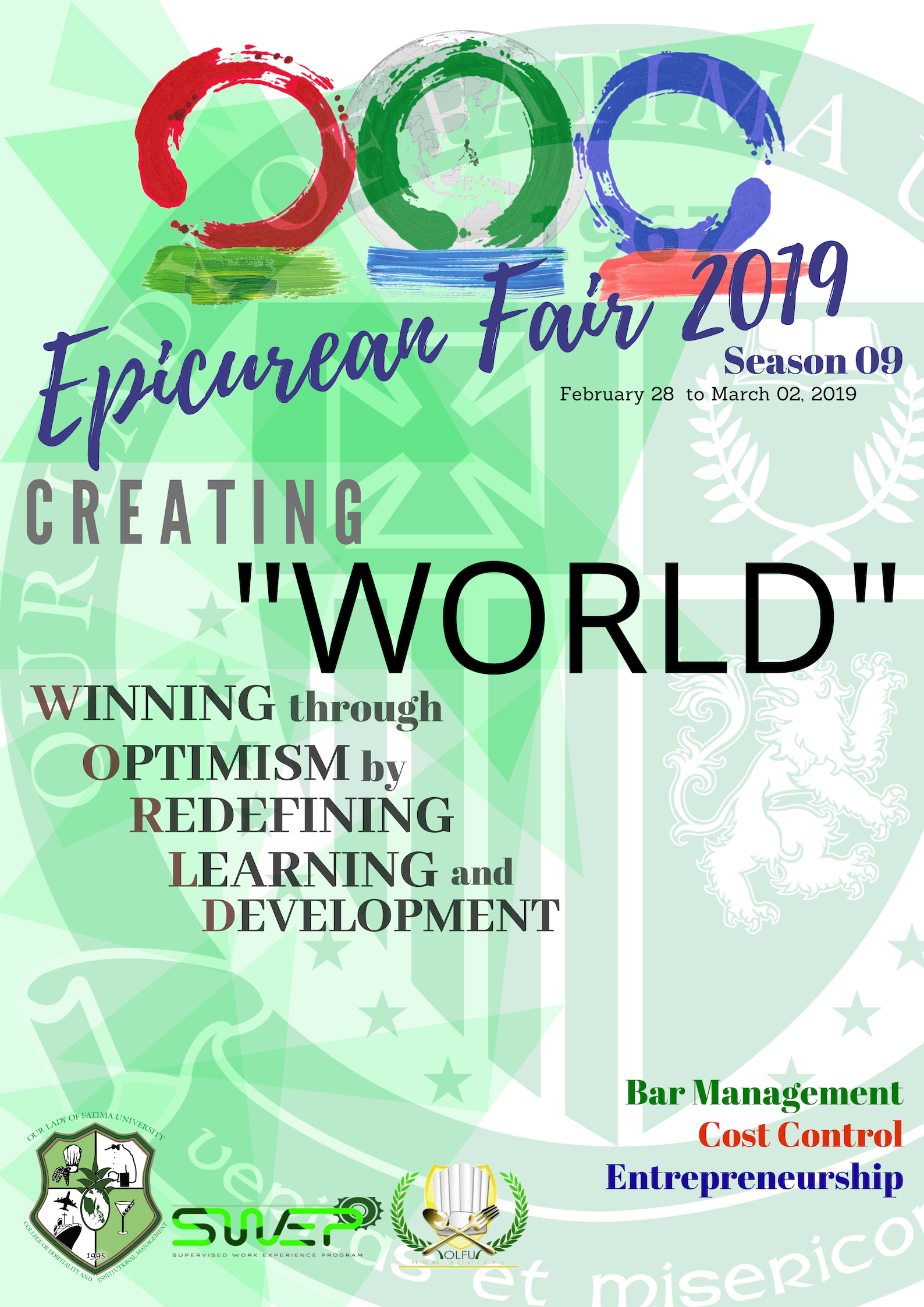
The Hospitality Management Department (HMD) under the supervision of College of Hospitality and Institutional Management (CHIM) holds EPICurean Fair 2019 at the university quadrangle last February 29 to March 02, 2019. The said event was also made possible through the join force of HRM Society, the college based club, and the Office of the Supervised Work Experience Program (SWEP), the office responsible for practicum.
This season, EPICurean Fair committee set hands to realize the theme: Creating W.O.R.L.D. which stands for WINNING through OPTIMISM by REDEFINING LEARNING and DEVELOPMENT
The event aims to showcase the student’s skills and creativity through this kind of culminating activity which usually happens at the end part of the course. The students have the chance to win friends through friendly competitions and create an ethical environment through sportsmanship, mock business operations, following standards, procedures and house rules, and application of university’s core values.
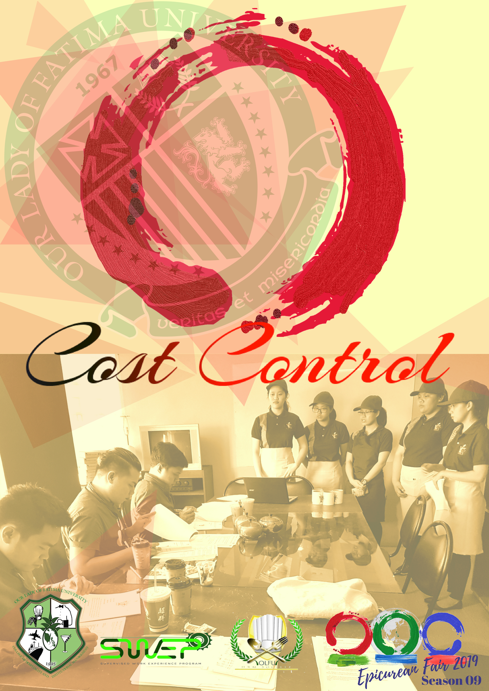
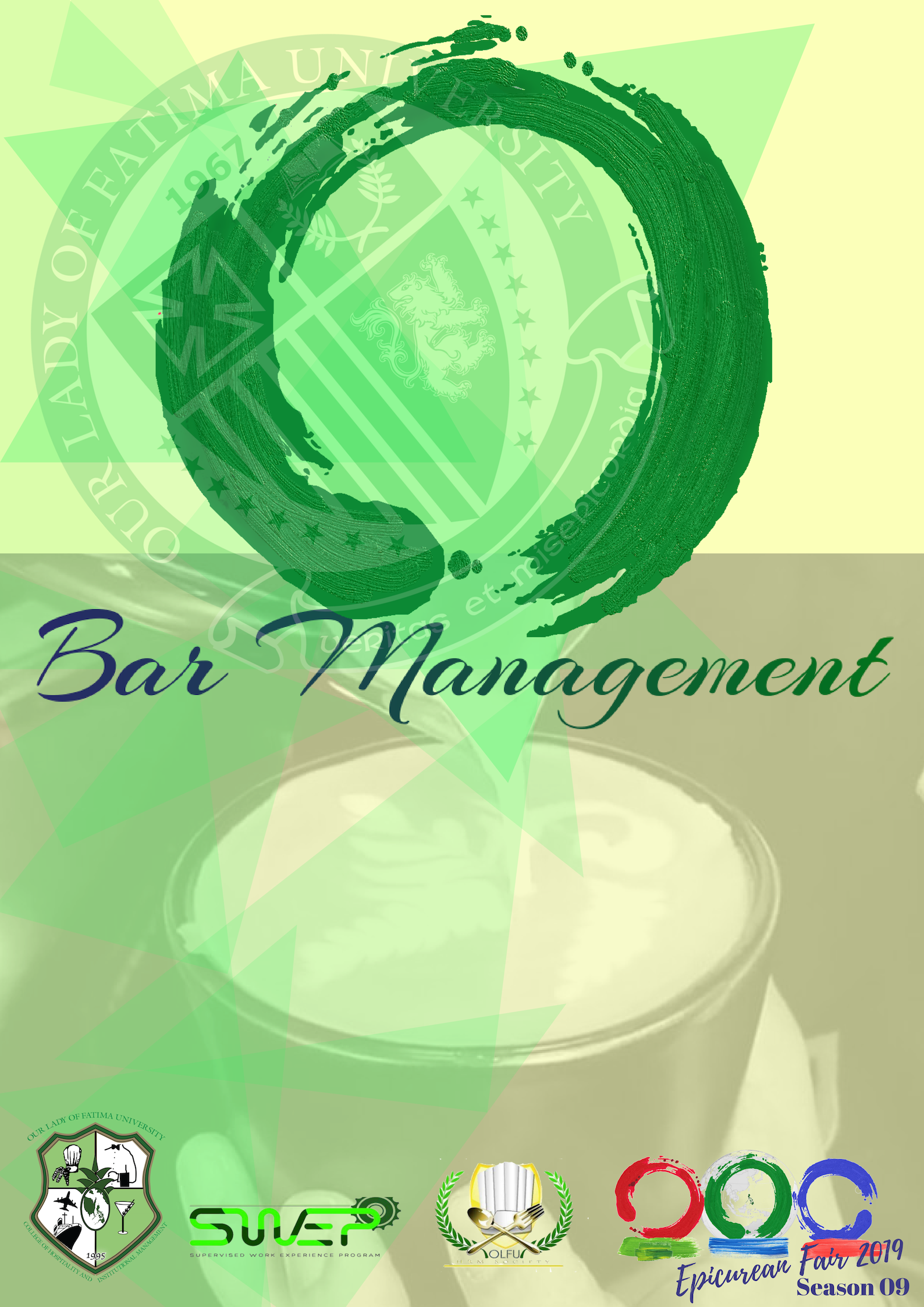
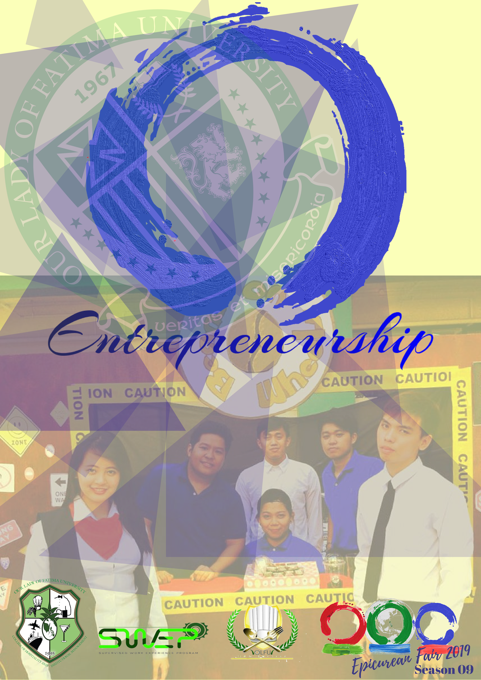
The three rings in the logo represent three courses participated in EPICurean Fair 2019 namely Cost Control, Bar Management, and Entrepreneurship.
The EPICurean Fair 2019 logo was inspired by three rings representing its respective course namely Cost Control, Bar Management, and Entrepreneurship.
The Red Ring represents the Cost Control Course headed by Ms. Kristine F. Sabordo
The “Red Ring” is for the Cost Control course. Budget distribution, food costing, interpretation of cashflows, and understanding the importance of business in essence are the concentration of this subject.
The Green Ring represents the Bar Management Course headed by Mr. Josephus B. Cayabyab and Shiela T. Garrido
The “Green Ring” is synonyms to Bar Management Course for this EPICurean Fair season. The course focuses on establishing restaurant and basic knowledge in preparation of different beverages such as non-alcoholic drinks, coffee and tea. The said course is a sequel of Bartending course that deals primarily to technical knowledge in alcoholic drinks, its preparation and some aspects written in TESDA Training Regulations.
The Blue Ring represents the Entrepreurship Course headed by Ms. Maria Paz Castro
The “Blue Ring” means Entrepreneurship
The event was spearheaded by the EPICurean 2019 Chairman Ms. Rachel Subando, and heads of different committee namely: Mr. Josephus B. Cayabyab holds Committee on Certificate and Awards, Committee on Seminar and Program, Committee on Rules and Procedures. Ms. Kristine F. Sabordo was in-charge in Committee of Finance and Budget, and the official tabulator for the event. Ms. Maria Paz Castro was the Head Researcher of the event. Ms. Shiela T. Garrido co-headed series of seminars, she also headed the Marketing Committee. Other faculty members of CHIM-HMD who took part in the success of the event are Ms. Emily Villaverde-Banzel and Ms. Nepomuceno.
The message of a marketing campaign should be persuading and influential in nature in order to deliver your objectives and create a hub where the target audience will engage to your campaign.
According to Liana Barcia of DEVEX in her article 4 great development advocacy campaigns, she said, “While some funds are of course necessary, good campaigns need not be expensive and are more about the hard work, creative thinking and energy you put into them. A strong advocacy campaign has well-researched and clear objectives and a detailed strategy and plan for reaching them. Organizing one requires a creative and multidisciplinary team and selection of the right channels. While traditional print and television remain popular, digital technology and social media have given rise to an alternative communication channel that is cheaper, more dynamic and even more powerful (source).” Her inputs on advocacy campaign is commendable and has given me greater insights and captured my interest in this topic.
1. Know Your Audience
A good marketing campaign should capture the soul and heart of its target audience and may influence others to be captivated by the message of an ads.
Macala Wright, a digital marketing strategist, suggests nonprofits with limited budgets take advantage of free resources to learn about online audiences. For instance, Google Analytics can tell you what country visitors to your website are from, where on your site they’re going and what devices (mobile, desktop, tablet) they’re using. “That’s information any organization can use to make informed decisions on how they’re messaging,” Wright said. (source)
2. Create Powerful Message
Simple, brief and concise message will help the audience to see directly your message than to read thousand of letters in an ads or campaign. Use powerful word directed to your audience. Once you hit their subconcious it will drive them crazy to reflect, agree, see your point or help them to realize something because you have given them pandoras box in your message.
Nowadays, #fakenews is epedemic! Creating marketing campaign should be science based, evidence-based, well-researched and relatable.
Josephus B. Cayabyab
Misleading heading can ruin the campaign and the organization working on that specific advocacy. Emphasize the need of your campaign, express your advocacy in a way that will hit their interest rather than impress them with your portfolios.
3. Use Your Theme
From font size and style to its colors are important elements, colors and its hues will draw attention, and inserting pictures or caricatures have power to immortalize your campaign.
A picture that can tell a thousand stories is an indicator of excellent campagin.
Josephus B. Cayabyab
4. Use Technology
In this generation, the 4th industrial revolution is all about technology where the combination of research and innovation have transformed to something great to reach the masses for consumption. A successful campaign should be consumed with ease by your target market through the help of technology. A campaign may be spread through different platforms at a lesser costs such Facebook, Twitter, Instagram, Youtube and many more.
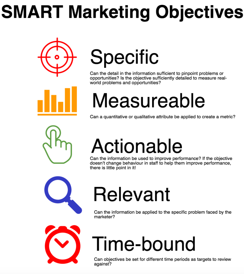
5. An Advocacy Campaign should be S. M. A. R. T.
Simple Measurable Achievable or Attainable Realistic and Relevant Time-bound
Define a Specific Outcome
Each objective must define a specific outcome. The goal should contain enough detail so that the people involved understand what results are expected. Generalities only create confusion and lead to poor results. Just having an objective to “get more business” is not helpful to anyone.
Defined Measurable Results An objective without a defined measurable result is like playing football and not keeping the score. Numbers are essential for keeping track of your progress toward a goal and defining the expected outcome. It is impossible to know if an objective has been reached unless it can be measured.
Goals Must be Achievable One way to assure certain failure is to set goals that no one believes can be reached in a realistic time period. Objectives are achieved by taking well-defined, measurable small steps on the path to the goal.
People must agree that the goals are attainable, and that they have the tools and skills needed to reach the objectives. The sales staff has agreed that increasing sales by 4 percent in the next six months is realistic and achievable.
Goals Must be Realistic Goals must be formed in the context of current economic conditions and realities of the business climate. It would be unrealistic to set a goal of increasing sales by 25 percent when a recession is looming on the horizon, and when three new competitors just opened up down the street.
Deadlines to meet a Timely Goal Experience shows that goals are not reached if there is no deadline specified. Efforts toward achieving a goal will meander, if a time expiration does not exist.
Thanks to the author James Woodruff James has been writing business and finance related topics for work.chron, bizfluent.com, smallbusiness.chron.com and e-commerce websites since 2007. The author also cited 3 references and 1 resources: References (3) University of North Carolina Wilmington: Writing SMART Learning Objectives Alma College: Setting “SMART” Goals and Brainstorming an Action Plan University of Wisconsin: SMART Goals Resources (1) Entrepreneur: How to Create a Marketing Plan (Source)
The marketing campaign should be eye-catchy. Yes, it should be palatable to the eyes. In making a campaign poster the eyes digest the message first before the content. Deciding to what picture or medium of interest to paste in your campaign matters a lot. It is like being attracted to a good-looking guys or gals first and learning about their character comes after and not the other way around, right?
7. Know your Grassroot (Grassroot Marketing)
Grassroots marketing, sometimes known as guerilla marketing, starts from the ground up. Instead of launching a message you hope will appeal to many people, you target your efforts to a small group and hope the group will spread your message to a much larger audience. Grassroots marketing often uses unconventional or nontraditional methods. Grassroots marketing often costs less than more conventional marketing efforts, but can produce big results.
Target people or groups you identify as influential, then count on them to use their influence to spread the word about your product or idea. (Source).
“Web Marketing for the Music Business”; Tom Huchison; 2008, pp. 37-38
The defining idea behind grassroots marketing is one of audience and intent. Whereas some campaigns aim to reach as many people as possible (think a brand awareness campaign on the Display network, for example), grassroots marketing is the principle of purposefully targeting a highly niche group of people in an attempt to persuade that group to then propagate your message organically.
Grassroots marketing relies heavily on social media and virality to succeed. Since the idea behind this kind of campaign is to encourage people to share a story, it follows that social media is pivotal in making this happen. (Source)
According to Adrienne Irizarry, Principal Owner, Leviosa Communication that “One of my most successful campaigns was a storytelling campaign. We chose several success stories with our product and told the story of how they use it and how by using it they were successful. We ran it as a series of short stories on our website and through social media — one a week featuring a different person or business — and it was wildly successful. People trust people so, in a way, it was a mini influencer campaign, long before influencer marketing really became a buzzword in the marketing world. The person featured shared it, that person’s family shared it and the ripple effect was remarkable. Our return was triple what we had projected.” (Source)
9. Ethical Response to an Issue
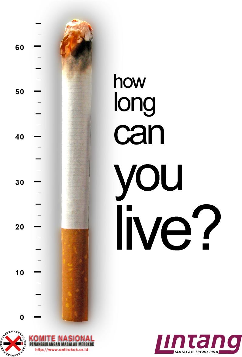
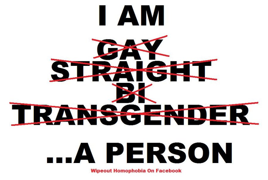
The advocacy campaign was not meant to destroy directly a certain entity but rather discourage bad habits (ex. anti-smoking drive) , make a call to end a certain issues (ex. domestic violence), imply for an action (ex. corruption), deliver message of change because of unfair practices (ex. discrimination and gender equality issues) and create an awakening ideas (ex. HIV-AIDS stigma, the downside of miing).
Although it is sometimes very challenging to convey an advocacy campaign without offending certain groups. If the advocacy campaign’s objective is to act against powerful forces such as norms, culture, heritage, politics, religion, influential people/group and history. A friction might arise in ascending rate and may create division. When touch these topics, sometimes we can only influence the tip of the ice berg which is just 1% of what we see. Therefore, strategy will bring huge help to achieve the goals. To evaluate the success of campaign is to check wether majority understand the message. If the campaign fails it does not mean that a certain cause or advocacy let say your group is campaigning to fight fake news, misinformation and disinformation but the public still believe of what they think is right (perception-based) and not what is legitimate. This may be because the opinion-maker of the information is influential and powerful in nature and they are part of spreading these fake stories as part of their propaganda. Here are the list of fake news site according to WikipediaPhilippine Star and Rappler. According to Preen.ph a certain known personality spread fake news that might influence its five million followers to think what she share is legit news (source).
The desire to create meaningful place to live, implementing goodness and fairly to one another and ethically sustainable issues may be hard to find most especially in religion, politics, business world and sometimes in journalism/news. The good news is universal truth always prevail in an advocacy campaign, and when I say universal truth it should be priciple-based (ex. universal gravitational pull), science-based (ex. depression is not just feelings but a mental illness), and well-researched (ex. Generation-Z respond to edgy campaigns)
10. Details of your Organization, Institution, Brand, or Group
Ofcourse you do not want to be labeled bogus or anti-social or central processor of destabilization, so, never ever forget to pin the profile of your group you are representing. Your brand will always make sense and its details will add legitimacy for your purpose such as name of the group/organization, valid email address (sometimes it looks legit if the email represent the company or organization you are part of ex. marketing_campaign@yourorganization.org.ph), contact details etc.
I have cited some of the BEST advocacy campaign available on different website, check them out below.
CUBA LIBRE Sometimes simple just works. At least it does when a double shot of rum, some cola, and a dash of lime are involved.
Cuba Libre
GLASS: Highball Glass/Collins Glass (or any tall glass) GARNISH: Slice of Lime/Lemon (half wheel) TECHNIQUE: Build INGREDIENT: 30 ml White Rum (Bacardi) Fill Coke (Regular)
MOJITO The Cuba Libre may have the actual name of Cuba in it, but the Mojito is the island nation’s most popular contribution to cocktail culture. The simple mix of white rum, lime juice, cane sugar, and soda is fresh and tropical without being cloying.
Mojito
GLASS: Highball Glass/Collins Glass/ Granite Glass (or any tall glass) GARNISH: Mint TECHNIQUE: Muddling INGREDIENT: 30 ml White Rum (Bacardi) Fresh Lemon/Lime Sliced Half-wheel (fruit to muddle) 3 Sprigs of Mint 15 ml. Sugar Syrup Soda Water (if you want to make your Mojito sweeter, use Sprite instead) 30 ml. Lime Juice
Muddle mint sprigs with sugar and lemon juice. Add rum and fill with soda water Top with lime juice. Garnish with mint leaves (sprig of mint leaves) & lemon sliced.
DAIQUIRI The Daiquiri is often abused with fruit and blenders, but a true Daiquiri made with white rum, lime juice, and simple syrup is a clean and refreshing drink for any occasion.
Daiquiri
GLASS : Champagne Saucer/ Martini Glass/ Cocktail Glass GARNISH: Sliced Lime/Lemon TECHNIQUE: Shake INGREDIENT: 30 ml. White Rum (Bacardi) 30 ml. Lime Juice 15 ml. Sugar Syrup
Bacardi
GLASS: Martini Glass/ Cocktail Glass GARNISH: Sliced Lime/Lemon TECHNIQUE: Shaken INGREDIENT: 30 ml. White Rum (Bacardi) 30 ml. Lime Juice 15 ml. Grenadine Syrup
Frozen Daiquiri
GLASS: Water Goblet Glass/Goblet GARNISH: None TECHNIQUE: Blend INGREDIENT: 60 ml. White Rum (Bacardi) 30 ml. Lime Juice 15 ml. Sugar Syrup 2 Scoops of Vanila Ice Cream
Blend all ingredients into blender (except ice cream) with crushed ice. Add one scoop of ice cream. Blend until smooth and pour into chilled goblet. Top with scoop of ice cream.
Pina Colada
GLASS: Poco Grande Glass GARNISH: Pineapple Wedge and Maraschino Cherry TECHNIQUE: Shake INGREDIENT: 30 ml. White Rum 45 ml. Coconut Cream Fill Pineapple Juice
Prepare crushed ice and put it in poco grande glass Shake rum and coconut cream, pour in poco grande glass. Fill pineapple juice. Garnish
Another option: Use blend method. Put all the ingredient in the blender with crushed ice. Served. Garnished.
Gin-based Drinks
TOM COLLINS Thirsty? You and Tom Collins belong together. The original Tom Collins made with gin, lemon, and soda water is the adult lemonade you’ve been looking for.
Tom Collins
GLASS: Collins Glass (Tall Drinks) GARNISH: Lemon/Lime Sliced and Maraschino Cherry TECHNIQUE: Build and Stir INGREDIENT: Old Tom Gin (Gin’s Brand Name) 30 ml. Gin 30 ml. Lime Juice or Fresh Lemon Juice 15 ml. Sugar Syrup Fill Soda Water Dash of Angostura bitter
To create “John Collins” Just use any brand of gin John Collins and Tom Collins are just the same
GIN FIZZ Plain Jane gin doesn’t work with the Gin Fizz, but a delicious craft gin can make the drink shine. The simple drink is a mix of gin, lemon, sugar, egg, and soda.
Gin Fizz
GLASS: Collins Glass GARNISH: None TECHNIQUE: Shaken INGREDIENT: 30 ml. Gin 30 ml. Fresh Lemon Juice 15 ml. Sugar Syrup 15 ml. Egg white (this can be an optional) Soda Water
Add all ingredient except for soda water. Dry shake (without ice) for 10 seconds. Add cubes of ice then shake it again. Strained using fined bar strainer into chilled glass. Pour club soda
GIMLET One sip of a Gimlet and it’s apparent why the classic cocktail is a favorite. Think of a proper Daiquiri, just with gin.
DRY MARTINI A well-made dry Martini is elegance personified. The classic mix of gin and dry vermouth
Dry Martini
GLASS: Martini Glass/ Cocktail Glass GARNISH: Olive TECHNIQUE: Stir INGREDIENT: 60 ml. Gin 15 ml. Dry Vermouth Squeeze oil from lemon peel onto the drink
Pour all ingredient into mixing glass with ice cube. Stir and strain. Squeeze oil from lemon peel onto the drink.
Perfect Martini
GLASS: Martini Glass/ Cocktail Glass GARNISH: Lemon Peel with Maraschino Cherry TECHNIQUE: Stir INGREDIENT : 60 ml. Gin 15 ml. Dry Vermouth 15 ml. Red Vermouth
Pour all ingredient into mixing glass with ice cube. Stir and strain. Garnish.
Sweet Martini
GLASS: Martini Glass/ Cocktail Glass GARNISH: Maraschino Cherry TECHNIQUE: Stir INGREDIENT : 60 ml. Gin 15 ml. Red Vermouth
Pour all ingredient into mixing glass with ice cube. Stir and strain. Garnish. Note: If served “ON THE ROCKS” Pour ingredients and a block of ice into old fashioned glass. Garnish.
Bronx
GLASS: Martini Glass/Cocktail Glass GARNISH: None TECHNIQUE: Shaken INGREDIENT: 30 ml. Gin 15 ml. Sweet Red Vermouth 15 ml. Dry Vermouth 30 ml. Orange Juice
Tequila-based Drinks
MARGARITA Are you even a bartender if you don’t know how to make a Margarita? Tequila’s favorite vessel is one of the most well-known and craved cocktails in America.
Margarita
GLASS: Margarita Glass GARNISH: Rimmed with salt (may add half wheeled lime) TECHNIQUE: Shaken INGREDIENT: 30 ml. Tequila 30 ml. Cointreau (if not available, use Tripple Sec) 30 ml. Lime Juice
Tequila Sunrise
GLASS: Highball Glass/Collins Glass GARNISH: Orange Slice and Maraschino Cherry TECHNIQUE: Build INGREDIENT: 30 ml. Tequila Orange Juice (to fill) Top with 15 ml. Grenadine Syrup to create chromatic effect. Do not stir.
Vodka-based Drinks
WHITE RUSSIAN The Dude would be proud. The White Russian is a creamy milk, vodka, and coffee liqueur drink that by no means is designed for all drinking occasions, but does have a time and a place.
COSMOPOLITAN Made iconic in “Sex and the City,” the Cosmo is filled with vodka, triple sec, cranberry juice, and lime juice. It’s the liquid soul of the early aughts and New York City, and it refuses to go away.
Cosmopolitan
GLASS: Large Cocktail Glass or Martini Glass GARNISH: Lemon Slice TECHNIQUE: Shaken INGREDIENT: 30 ml. Vodka 30 ml. Lemon/Lime Juice 15 ml. Cointreau (if not available use triple sec) 30 ml. Cranberry Juice
BLOODY MARY Brunch and breakfast will never let the Bloody Mary die. What else besides a house mix of tomato juice, vodka, and spices could make drinking in the early sunlight hours acceptable?
Bloody Mary
GLASS: Collins Glass/Highball Glass GARNISH: Celery Stalk (and Lemon Wedge) TECHNIQUE: Build INGREDIENT: 30 ml. Vodka Tomato Juice (to fill) 15 ml. Lemon Juice Dash Worcestershire Sauce Dash Tabasco Dash of Salt and Pepper
Add:Dash worcestershire sauce, dash Tabasco, dash of salt and pepper into highball glass. Pour all ingredients. Stir and garnish.
GOD FATHER More of a Scotch-forward mixed drink than a cocktail, the Godfather is an easy equal parts Scotch whisky and amaretto. It made the World’s 50 Best Selling Classic list for the first time this year.
GLASS: Rock Glass (or Old Fashioned Glass as substitution) GARNISH: None TECHNIQUE: Stirred INGREDIENT: 30 ml. Bourbon/Whiskey/Scotch 15 ml. Amaretto
ROB ROY The Rob Roy is the Scotch version of the classic Manhattan. It was invented at the Waldorf hotel in New York in 1894, and calls for a blended Scotch rather than rye whiskey.
That simple cocktail likely came to be because of Waldorf Astoria’s original location on Fifth Avenue in the lower 30s from 1893 to 1929, conveniently perched smack within the Great White Way, the original well-lit section of the city devoted to the stage arts.
It was here, according to Caiafa, also the author of “The Waldorf Astoria Bar Book,” that a Herald Square Theatre production of an operetta named “Rob Roy” by the composer Reginald De Koven inspired the birth of a drink. It’s a tidy origin story, no doubt. And though it lacks the often-cited exclamations of fuzzy impossible-to-pin characters in drinking lore, it’s a fairly plausible scenario. (Source)
Rob Roy
GLASS: Coupe or Cocktail Glass GARNISH: Lemon Peel TECHNIQUE: Stirred INGREDIENT: 30 ml. Blended Scotch 30 ml. Sweet Vermouth 1 dash of Orange Bitters or Angostura Bitter
More than One (1) Spirits
LONG ISLAND ICED TEA It’s not for the faint of heart, and features rum, gin, vodka, tequila, and triple sec mixed into cola and citrus.
On paper, the Long Island Iced Tea is one hot mess of a drink. Four different—and disparate—spirits slugging it out in a single glass, along with triple sec, lemon juice and cola? The recipe reads more like a frat house hazing than one of the world’s most popular cocktails. And yet, somehow, it works.
That’s because the Long Island Iced Tea succeeds where so many of today’s refined cocktails fall short: It’s boozy AF—more than four ounces of alcohol against less than half that amount in mixers. Unless you’re a sailor on shore leave, that’s a red-flag ratio rife with morning-after consequences. It’s also precisely what a person needs every now and then. (Source)
Long Island Iced Tea
GLASS: Collins Glass (or any Tall Glasses as substitution) GARNISH: Lemon Wedge TECHNIQUE: Build INGREDIENT: 15 ml. Gin 15 ml. White Rum 15 ml. Silver Tequila 15 ml. Vodka 15 ml. Triple Sec 15 m. Sugar Syrup 15 ml. Fresh Lemon Juice (substitution is Lime Juice) Cola, to top
Add all the ingredients except the cola into a Collins glass with ice. Top with a splash of the cola and stir briefly. Garnish with a lemon wedge.
MAI TAI Nothing represents the tiki movement quite like the Mai Tai. It’s hard to resist the lifeline to the tropics that is the Mai Tai — kitsch be damned.
GLASS: Collins GLass or Highball Glass or Double Old Fashioned Glass GARNISH: Lime Wheel, Mint Sprig TECHNIQUE: INGREDIENT: 30 ml. White Rum 15 ml. Orange Curacao 15 ml. Fresh Lime Juice 15 ml. Orgeat (Almond Syrup) 15 ml. Dark Rum
Add the White rum, curaçao, juice and orgeat into a shaker with crushed ice and shake lightly (about 3 seconds). Pour into a double Old Fashioned glass, then float the Dark rum. Garnish with a lime wheel and mint sprig. (Source)
Layer the ingredient accordingly (Kahlua first, then Bailey’s, and lastly, Grand Marnier). Use bar spoon with Grand Marnier to transfer flame into the shot glass.
This region is characterized by substantial inequality in the economic development of countries. And the capital cities here often have higher standards of living compared to other towns.
South America, fourth largest of the world’s continents. It is the southern portion of the landmass generally referred to as the New World, the Western Hemisphere, or simply the Americas. The continent is compact and roughly triangular in shape, being broad in the north and tapering to a point—Cape Horn, Chile—in the south.
Relatively few islands rim the continent, except in the south. These include the glaciated coastal archipelagoes of Argentinaand Chile. The Falkland (Malvinas) Islands are east of southern Argentina. To the north, the West Indies stretch from Trinidad to Florida, but those islands usually are associated with North America. Of the remainder, most are small oceanic islands off the coasts of South America, including the Galapagos Islands, Ecuador, in the Pacific Ocean.
Alphabetical list of capital cities in South America
Country
Capital city
A
Argentina
Buenos Aires
B
Bolivia
Sucre (de jure), La Paz (seat of government)
Brazil
Brasilia
C
Chile
Santiago
Colombia
Bogotá
E
Ecuador
Quito
G
Guyana
Georgetown
P
Paraguay
Asunción
Peru
Lima
S
Suriname
Paramaribo
U
Uruguay
Montevideo
V
Venezuela
Caracas
South American Trivia
South America, at (17,819,000 sq km), is the fourth largest continent in the world.
Brazil, at 8,456,510 sq km, (3,265,059 sq miles), is the fifth largest country in the world. Argentina, at 2,736,690 sq km, (1,056,636 sq miles) is the eighth largest.
Two of the five longest rivers in the world are in South America: the Amazon at 4,087 miles and the Parana at 3,032 miles. The Amazon is visible from space.
For sheer volume of water, the Amazon is the Greatest River.
The Amazon river basin is the largest contiguous tropical rainforest in the world. The Amazon and its tributaries form an area called Amazonia.
The Andes are the longest mountain range in the world, extending more than 4000 miles through seven countries down the western portion of South America.
The highest waterfall in the world is Angel Falls, Venezuela where water falls 3,281 feet from the top to the base in a series of steps.
Buenos Airesis the second largest city with with 11.96 million inhabitants living within the city limits. With those outside the city limits, it has 12.91 million inhabitants, making it the fourteenth largest city.
São Paulo, Brazil with 18.5 million inhabitants is the fifth largest city in the world and the largest in South America. Population Density
Lake Titicaca is the highest navigable lake in the world.
Buenaventura, Colombia with 267″ rain per year is the wettest inhabited place on earth. Other sources say Quibido, Colombia, the rainiest place in South America, receives more than 350 inches (890 centimeters) of rain.
The third, fourth and fifth inhabited places with the least recorded rainfall are Arica Desert, Chile 0.04″, Ica, Peru 0.1″ and Antofagasta, Chile 0.2″.
The Atacama desert of Chile with 54,000 sq. miles is the largest cool, coastal desert. The oasis at San Pedro de Atacama has supported life for thousands of years. Driest Place .
The Argentine Patagonian desert with 260,000 sq. miles is the second largest cold winter desert.
Suriname has the tenth lowest density population of 7.0 people per square mile.
Chile had the world’s greatest recorded earthquake in 1960. Greatest Earthquake
Iguazu Falls are shared by two countries: Argentina and Brazil.
The only still growing glacier is Perito Moreno. Read more about the Glaciers of Argentina
While most of South America was liberated from the colonial powers of Spain and Portugal, two small areas of the continent are still administered by European countries, and in terms of per capita income are the wealthiest areas of the continent. French Guiana is located on the north coast of the continent, while off the east coast of Argentina, the Falkland Islands, known as the Malvinas by Argentinians, is a British Overseas Territory.
The Amazon rainforest is considered to have the greatest biodiversity in the world, with hundreds of different animals species, around 40,000 plant species and a stunning 2.5 million different species of insects.
Religion is an important part of the culture in South America, and across the continent, around 90% of people identify themselves as Christians. 82% of the continent’s population consider themselves to be Roman Catholic.
Chile is home to the world’s driest non-polar desert, the Atacama Desert, and parts of the central desert area are known to regularly go without rain for up to four years at a time.
South America was discovered by the Italian explorer Amerigo Vespucci, and at the end of the 15th century and the start of the 16th century, he spent a long time exploring the eastern coast of the continent.
Ramos, V. A., Avila, H. F., Germani, G., Griffin, E. C., Dorst, J. P., & Gade, D. W. (2018, September 26). South America. Retrieved January 13, 2019, from https://www.britannica.com/place/South-America
“I think that the US and the Philippines have always had a good relationship with each other. We’ve been colonized by the Americans and we have their culture in our traditions even up to this day. The Philippines is very welcoming with the Americans and I don’t see any problem with that at all.” –Pia Alonzo Wurtzback Representing Philippines during the Ms. Universe 2015 Top 5 Q&A portion
The USA is the world’s foremost economic and military power, with global interests and an unmatched global reach.
The United States originated in a revolution which separated it from the British Crown. The constitution, drafted in 1787, established a federal system with a division of powers which has remained unchanged in form since its inception.
Timeline
1565 – First permanent European settlement in North America.
17th-18th centuries – Hundreds of thousands of Africans brought over and sold into slavery to work on cotton and tobacco plantations.
1775 – American Revolution: George Washington leads colonist Continental Army to fight against British rule.
1787 – Founding Fathers draw up new constitution for United States of America. Constitution comes into effect in 1788.
19th century – Residual resistance by indigenous people crushed as immigration from Europe assumes mass proportions, with settlers moving westwards.
1861-1865 – US Civil War: Federalist forces defeat the Confederate pro-slavery states in the South. Slavery is abolished under the Thirteenth Amendment.
1929-33 – 13 million people become unemployed after the Wall Street stock market crash of 1929 triggers what becomes known as the Great Depression.
1941 – Japan attacks the US fleet at Pearl Harbour in Hawaii, precipitating the United States’ entry into World War Two.
1954 – Racial segregation in schools becomes unconstitutional; start of campaign of civil disobedience to secure civil rights for Americans of African descent.
2001 11 September – Co-ordinated suicide attacks on various high-profile targets by the al-Qaeda jihadist group, prompting the US to embark on a ”war on terror” which includes the invasion of Afghanistan and Iraq.
2008 – Barack Obama is elected the first black president of the United States.
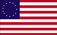
United States, officially United States of America, abbreviated U.S. or U.S.A., byname America, country in North America, a federal republic of 50 states. Besides the 48 conterminous states that occupy the middle latitudes of the continent, the United States includes the state of Alaska, at the northwestern extreme of North America, and the island state of Hawaii, in the mid-Pacific Ocean. The conterminous states are bounded on the north by Canada, on the east by the Atlantic Ocean, on the south by the Gulf of Mexico and Mexico, and on the west by the Pacific Ocean. The United States is the fourth largest country in the world in area (after Russia, Canada, and China). The national capital is Washington, which is coextensive with the District of Columbia, the federal capital region created in 1790.
Donald, D., Bradley, H., Schmidt, K., Economist Intelligence Unit, Lewis, P. F., Oehser, P. H., . . . Zelinsky, W. (2019, January 06). United States. Retrieved January 11, 2019, from https://www.britannica.com/place/United-States/
The fact is Canadians understand that immigration, that people fleeing for their lives, that people wanting to build a better life for themselves and their kids is what created Canada, it’s what created North America.
North America is the third largest of the seven continents. It is bordered by the Atlantic Ocean to the east and the Pacific Ocean to the west. North America is dominated by its three largest countries: Canada, Mexico, and the United States. Central America and the Caribbean are usually considered part of North America
North America History
Anthropologists believe that North America’s initial inhabitants arrived around 40,000 years ago by traversing theBering Strait. Some experts feel that by using primitive boats, early man also migrated down the Pacific coast to South America; that debate continues.
There is scientific evidence connecting indigenous Americans to Asian peoples, specifically from the easternSiberian populations. Indigenous peoples of the Americas have been linked to North Asian populations by linguistic dialects and blood types.
After the last glacial period ended some 12,500 years back, a wide variety of prehistoric cultures developed across the continent, north to south. The development of stone tools was one of the factors instrumental in that successful expansion.
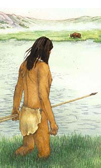
Long before the Europeans arrived, small groups developed throughout the Americas. Across the Great Plains hunter-gatherers existed on wild plants and animals, but they were eventually replaced by more sophisticated bands that farmed the land, raised some animals and improved their hunting skills.
In the far-southern reaches of the continent important cultural advances were made by the Maya civilization. They developed written language, as well as far-reaching advances in art, architecture, astronomical systems and mathematics. From the years 250 to 900, they were at the pinnacle of their power.
In North America, sophisticated pre-Columbian cultures continued to develop. Across regions of what is now the United States, social organization were building mound complexes, with some supporting sizable communities year-round.
Native American societies continued to spread; the Inuit and the Aleut lived in domed-shaped dwellings in the Arcticregions while large groups inhabited the Subarctic parts of Alaska and western Canada. From the Northeast to the Southeast, and from the Plains to the Southwest, the expansion continued unabated.
As large groups gained additional knowledge, they began to farm some familiar crops now used around the world, such as tomatoes and squash. Perhaps most importantly they developed farming techniques for one of the planet’s major foods, maize (corn).
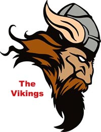
The Vikings were seafaring north Germanic people who raided, traded, explored, and settled in wide areas of Europe,Asia, and the North Atlantic islands from the late 8th to the mid-11th centuries. Using sturdy wooden longships they traveled as far west as Iceland,Greenland, and Newfoundland. Leif Erikson is believed to have reached the Island of Newfoundland, Canada – circa 1000 AD
In 1492, after proposing a voyage of discovery to the then mostly-imagined New World, Christopher Columbus left Spain on an epic journey, financed by Isabella I and Ferdinand II, Queen and King of Spain. Within a few months he reached land in the Bahamas, and North America would change forever.
After Columbus made his initial voyage to this New World, word of its potential riches spread across Europe and explorers and settlers by the thousands would eventually step ashore along the Atlantic Ocean coastline of North America.
John Cabot explored the east coast of what would become Canada in 1497. Giovanni da Verrazzano explored the East Coast of North America from Florida to eastern Canada in 1524, and Jacques Cartier made a series of voyages on behalf of the French crown in 1534 and penetrated the St. Lawrence River.
In 1500, the Spanish made their move to colonize parts of the New World. The city of Nueva Cádiz was founded on the Venezuela island of Cubaqua. In 1510 they established Santa María la Antigua del Darien near the border of Colombia and Panama: these were the first European settlements in the Americas.
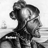
The first mainland Spanish explorations were a series of inland expeditions that led to the conquest of Mexico and the Yucatan Peninsula. In 1513, Vasco Nunez de Balboa crossed the Isthmus of Panama to find gold, but instead led the first European expedition to the Pacific Ocean and the west coast of the New World.
Balboa then claimed the Pacific Ocean and all the lands adjoining it for the Spanish Crown. Hernan Cortes and his conquistadors came ashore at present day Veracruz, Mexico on April 22, 1519, and it marked the beginning of 300 years of dominate Spanish influence over most of Mexico,Central America and the Caribbean.
In 1539, Hernando de Soto landed at Tampa Bay in what is now the US State of Florida. With 600 soldiers in tow, his goal was to find gold for the Spanish Crown. At that same time natives on the continent lived without fear as they were ignorant of the outside world. Soon their innocence disappeared, as Europeans began to stake their claims, frequently in brutal ways.
As a result of European exploration the Native American population declined substantially, primarily due to the introduction of European diseases to which the Native Americans lacked immunity, as well as from violent conflicts where they were no match for European fire power.
Not to be outdone, Britain and France (as well as Spain) were beginning to establish extensive territories in the northern reaches of the continent. Even lesser-powers like the Netherlands and Sweden laid claim to smaller parts.
The first French settlements were established at Port Royal (1604) and Quebec City (1608) in what is now Nova Scotia and Quebec, Canada. In 1607, the first successful English settlement was built at Jamestown, Virgina,followed by the Plymouth, Massachusetts colony in 1620.
Near the end of the 17th century the colonialism of North America was at full speed, and inevitable disagreements and greed were the genesis for a series of regional wars, and some of the European territories changed hands multiple times. In fact, the Caribbean island of Tobagochanged hands 33 times.
In the middle of the 18th century, independence movements were on the front-burner across the continent. An American Revolution was brewing within the English colonies, Spain’s hold on Mexicowas weakening and slave revolts were common in the Caribbean.
By the end of the century, a handful of independence movements came to fruition across the North America continent. The 13 original British Coloniesdeclared independence in 1776, and after the American Revolutionary War ended in 1783, they became the United States of America.Canada was formed from the unification of northern territories once controlled by Britain and France.
New Spain, a territory that stretched from the southwestern modern-day U.S. through Central America declared independence in 1810, becoming the First Mexican Empire. Guatemala,then part of that Mexican Empire, became the first independent state in Central America.
For many reasons, including the possibility of America’s interest in annexingCanada, the War of 1812 began when the United States declared war on the British. The 32-month military conflict (fought on many fronts) resulted in no territorial change between the British Empire and the USA, but a resolution of many issues which remained from the American War of Independence.
With space too limited here to detail, we highlight a series of important land agreements and compromises that occurred in North America through the end of the 19th century. They include: The Republic of Texas formed as an independent sovereign nation in 1836; the Rebellions of 1837 in Lower and Upper Canada; the creation of the Mexican Empire, with the support of Napoleon III of France in 1864, and the creation of the Dominion of Canada in 1867.
Arguably, the two most devastating events on the North America continent were the American Civil War (from 1861 to 1865), a conflict that led to the end of slavery in the United States, but it brought destruction to most of the South, and a tremendous loss of life. It was followed by the United States government fighting numerous Indian Wars against the Native Americans for land acquisition; tens of thousands died as a result.
Following the Civil War, America’s intervention into Latin America and elsewhere expanded. The 1867 Alaska Purchase was the acquisition of what is now the US State of Alaska from the Russian Empire. During the Spanish–American War of 1898, the US seized several colonies from Spain including Cuba and Puerto Rico.
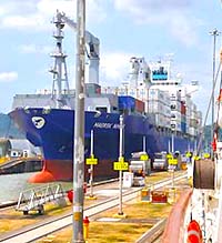
In 1914, the Panama Canal opened. the 48-mile (77.1 km) ship canal in Panama connecting the Atlantic Ocean (via the Caribbean Sea) to the Pacific Ocean enabled ships to avoid the lengthy Cape Hornroute around the southernmost tip of South America.
At the end of World War I (fought from 1914 to 1918 in Europe) the early 20th century brought an age of great prosperity to the United States, and to a lesser degree Canada. But the Stock Market Crash of 1929 was the most devastating stock market crash in the history of the United States, and that crash affected all Western industrialized countries and did not end in the United States until the onset of American mobilization for World War II in 1941.
In Mexico, from 1936 to 1949, there was a popular uprising against the anti-Catholic government. In the Caribbean, many islands witnessed the beginnings of decolonization, while on the island of Cuba, the Cuban Revolution introduced the Soviet Union (now Russia) into Latin America.
World War II was a global conflict that lasted from 1939 to 1945. It involved the vast majority of the world’s nations—including all of the great powers, including Canada and the US. The destruction of Europe wrought by the war vaulted all North American countries to more important roles in world affairs, and the United States emerged as a “superpower.”
Mexico also experienced an era of huge economic growth after World War II, a heavy industrialization process and a growth of its middle class, a period known in Mexican history as the “El Milagro Mexicano” (Mexican miracle). In 1960, Guatemala,El Salvador,Hondurasand Nicaragua banded together to find a common economic bond.
The early Cold War era saw the United States as the most powerful nation in a Western coalition of which Mexicoand Canada were also a part. At home, the United States witnessed violent change especially in the area of race relations. In Canada this was mirrored by the Quiet Revolution and the emergence of Quebec nationalism.
During this time the United States became involved in the Vietnam War. That war would later prove to be highly divisive in American society, and American troops were withdrawn. Canada during this era was dominated by the leadership of Pierre Elliot Trudeau. Eventually in 1982 at the end of his tenure, Canada had a new constitution.
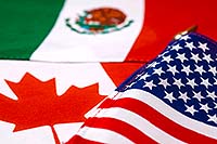
Major changes continued into the 21st century: Mexico experienced a strong economic recession in the 1980s, the Canada-United States Free Trade Agreement was reached in January 1989, and on January 1, 1994, Canada,Mexico and the United States of America signed the North American Free Trade Agreement, creating the world’s largest free trade area.
Those major economic events were followed by the 9/11 attacks on the United States, and the subsequent war in Afghanistan – participated in by Canada and the US. In 2006, the violent drug war spread from Central America to Canada, and that human tragedy reached a deadly peak in Mexico in the last few years. In 2008, a financial crisis that began the United States eventually triggered a worldwide recession, an economic slowdown that has now wained some.
Surviving powerful earthquakes, hurricanes, tornadoes, contentious immigration issues and isolated terrorism attacks, the twenty-three countries and the dozens of possessions and territories within North America have found ways to (for the most part) co-exist in peace, and to economically benefit by working together. Today the diverse and massive continent of North America present a bright potential future for all of its people, and for that matter, much of the modern world.
North America Geography Notes
Two of North America’s most interesting geographical features are the Great Plains and the Mississippi River System; both impressive in so many ways.
Great Plains: The Great Plains of North America slope east from the Rockies and extend to the edge of the Canadian Shield and the western edges of the Appalachians. The land is generally smooth with large treeless areas and shallow river valleys. Minor hills and mountains are found in the Ozark Plateau of Missouri, and in the Boston Mountains and Ouachita Mountains of northwestern Arkansas and eastern Oklahoma. Sandhills and buttes cover parts of the north central U.S. in Nebraska.
Mississippi River System: It is the major river of North America and the United States at (2,339 miles) (3,765 km) in length. It flows from northwestern Minnesota south to the Gulf of Mexico, just below the city of New Orleans. It is a significant transportation artery and when combined with its major tributaries (the Missouri and Ohio rivers) it becomes the third largest river system in the world at (3,877 miles) (6,236 km) in length.
North America Geography Facts
Percent of Earth’s Land: 16.5%
Highest Point: Mt McKinley in Alaska, 20,322ft (6,194m) (see map)
Lowest Point: Death Valley in California, -282 ft (-86m) below sea level (see map)
Geographic Center: The United States Geographical Survey states that the geographic center of North America is “6 miles west of Balta, Pierce County, North Dakota” at approximately 48° 10´ N 100° 10´ W. (see map)
Horizontal Width: From San Francisco, California, east to New York City, NY: 2,582 miles (4,156 km) (see map)
Vertical Length: From Barrow, Alaska, directly southeast to Panama City, Panama: 5,347 miles (8,605 km) (see map)
Note: Lengths and widths are point-to-point, straight-line measurements and will vary some using other map projections.
Note: For additional geography details please use the yellow navigation bar at the top of this page.
North America Information
Links to North America information that are updated daily.
Alphabetical List of Capital Cities in North America
Country
Capital city
A
Antigua and Barbuda
Saint John’s
B
Bahamas
Nassau
Barbados
Bridgetown
Belize
Belmopan
C
Canada
Ottawa
Costa Rica
San Jose
Cuba
Havana
D
Dominica
Roseau
Dominican Republic
Santo Domingo
E
El Salvador
San Salvador
G
Grenada
Saint George’s
Guatemala
Guatemala City
H
Haiti
Port-au-Prince
Honduras
Tegucigalpa
J
Jamaica
Kingston
M
Mexico
Mexico City
N
Nicaragua
Managua
P
Panama
Panama City
S
Saint Kitts and Nevis
Basseterre
Saint Lucia
Castries
Saint Vincent and the Grenadines
Kingstown
T
Trinidad and Tobago
Port of Spain
U
United States of America
Washington, D.C.
List of dependent territories in North America
A: Anguilla (UK), Aruba (Netherlands)
B: Bermuda (UK), Bonaire (Netherlands), British Virgin Islands (UK)
C: Cayman Islands (UK), Clipperton Island (France), Curacao (Netherlands)
G: Greenland (Denmark), Guadeloupe (France)
M: Martinique (France), Montserrat (UK)
N: Navassa Island (USA)
P: Puerto Rico (USA)
S: Saba (Netherlands), Saint Barthelemy (France), Saint Martin (France), Saint Pierre and Miquelon (France), Sint Eustatius (Netherlands), Sint Maarten (Netherlands)
T: Turks and Caicos Islands (UK)
U: US Virgin Islands (USA)
Did You Know?
The name America is derived from that of the Italian merchant and navigator Amerigo Vespucci, one of the earliest European explorers to visit the New World. Although at first the term America was applied only to the southern half of the continent, the designation soon was applied to the entire landmass. Those portions that widened out north of the Isthmus of Panama became known as North America, and those that broadened to the south became known as South America. According to some authorities, North America begins not at the Isthmus of Panama but at the narrows of Tehuantepec, with the intervening region called Central America. Under such a definition, part of Mexico must be included in Central America, although that country lies mainly in North America proper. To overcome this anomaly, the whole of Mexico, together with Central and South American countries, also may be grouped under the name Latin America, with the United States and Canada being referred to as Anglo-America. This cultural division is a very real one, yet Mexico and Central America (including the Caribbean) are bound to the rest of North America by strong ties of physical geography. Greenland also is culturally divided from, but physically close to, North America. Some geographers characterize the area roughly from the southern border of the United States to the northern border of Colombia as Middle America, which differs from Central America because it includes Mexico. Some definitions of Middle America also include the West Indies.
North America contains some of the oldest rocks on Earth. Its geologic structure is built around a stable platform of Precambrian rock called the Canadian (Laurentian) Shield. To the southeast of the shield rose the ancient Appalachian Mountains; and to the west rose the younger and considerably taller Cordilleras, which occupy nearly one-third of the continent’s land area. In between these two mountain belts are the generally flat regions of the Great Plains in the west and the Central Lowlands in the east.
North America’s first inhabitants are believed to have been ancient Asiatic peoples who migrated from Siberia to North America sometime during the last glacial advance, known as the Wisconsin Glacial Stage, the most recent major division of the Pleistocene Epoch (about 2.6 million to 11,700 years ago). The descendants of these peoples, the various Native Americanand Eskimo (Inuit) groups, largely have been supplanted by peoples from the Old World. People of European ancestry constitute the largest group, followed by those of African and of Asian ancestry; in addition there is a large group of Latin Americans, who are of mixed European and Native American ancestry.
The study of the physical features of the earth. Includes
study of regional formations and their relation to humans.
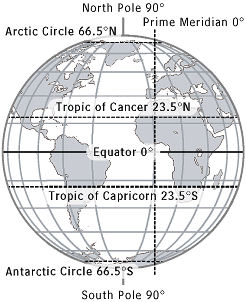
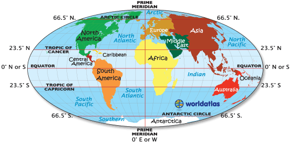
Latitude Lines
Imaginary lines running horizontally around the globe.
Also called parallels, latitude lines are equidistant from each other. Each
degree of latitude is about 69 miles (110 km) apart. Zero degrees (0°) latitude
is the equator, the widest circumference of the globe. Latitude is measured
from 0° to 90° north and 0° to 90° south—90° north is the North Pole and 90°
south is the South Pole.
Longitude lines
Imaginary lines, also called meridians, running
vertically around the globe. Unlike latitude lines, longitude lines are not
parallel. Meridians meet at the poles and are widest apart at the equator. Zero
degrees longitude (0°) is called the prime meridian. The degrees of longitude
run 180° east and 180° west from the prime meridian.
Geographic coordinates
Latitude and longitude lines form an imaginary grid over
the Earth’s surface. By combining longitude and latitude measurements, any
location on earth can be determined. The units of measurement for geographic
coordinates are degrees (°), minutes (′), and seconds (″). Like a circle, the
Earth has 360 degrees. Each degree is divided into 60 minutes, which in turn is
divided into 60 seconds. Latitude and longitude coordinates also include
cardinal directions: north or south of the equator for latitude, and east or west
of the prime meridian for longitude. The geographic coordinates of New York
City, for example, are 40° N, 74° W, meaning that it is located 40 degrees
north latitude and 74 degrees west longitude. Using minutes and seconds as well
as degrees, the coordinates for New York would be 40°42′51″ N, 74°0′23″ W.
(Latitude is always listed first.) A less common format for listing coordinates
is in decimal degrees. The Tropic of Cancer, for example, can be expressed in
degrees and minutes (23°30′ N) or in decimal degrees (23.5° N).
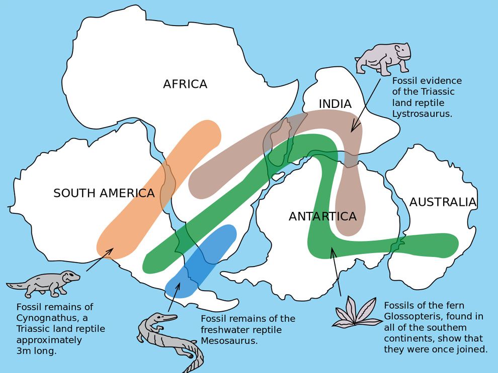
Continental Drift
Theory that the earth’s continents at one time were oncepart of a singular landmass. It is believed that the continents have spread outdue to plate tectonics.
Continental drift describes one of the earliest ways geologists thought continents moved over time. This map displays an early “supercontinent,” Gondwana, which eventually moved to form the continents we know today. Fossils of similar organisms across widely disparate continents encouraged the revolutionary theory of continental drift. Map by USGS
Hemisphere
A hemisphere is half the Earth’s surface. The four
hemispheres are the Northern and Southern hemispheres, divided by the equator
(0° latitude), and the Eastern and Western hemispheres, divided by the prime
meridian (0° longitude) and the International Date Line (180°).
Equator
Zero degrees latitude. The Sun is directly overhead the
equator at noon on the two equinoxes (March and Sept. 20 or 21). The equator
divides the globe into the Northern and Southern hemispheres. The equator
appears halfway between the North and South poles, at the widest circumference
of the globe. It is 24,901.55 miles (40,075.16 km) long.
Prime Meridian
Zero degrees longitude (0°). The prime meridian runs
through the Royal Greenwich Observatory in Greenwich, England (the location was
established in 1884 by international agreement). The prime meridian divides the
globe into the Western and Eastern hemispheres. The Earth’s time zones are
measured from the prime meridian. The time at 0° is called Universal Time (UT)
or Greenwich Mean Time (GMT). With the Greenwich meridian as the starting
point, each 15° east and west marks a new time zone. The 24 time zones extend
east and west around the globe for 180° to the International Date Line. When it
is noon along the prime meridian, it is midnight along the International Date
Line.
International Date
Line
Located at 180° longitude (180° E and 180° W are the same
meridian). Regions to the east of the International Date Line are counted as
being one calendar day earlier than the regions to the west. Although the
International Date Line generally follows the 180° meridian (most of which lies
in the Pacific Ocean), it does diverge in places. Since 180° runs through
several countries, it would divide those countries not simply into two
different time zones, but into two different calendar days. To avoid such
unnecessary confusion, the date line dips and bends around countries to permit
them to share the same time.
Tropics
Also referred to as the torrid zone or tropical zone, all
the water and land of the earth between the Tropic of Cancer and the Tropic of
Capricorn. The tropics experience at least one day per year in which the sun
passes directly overhead.
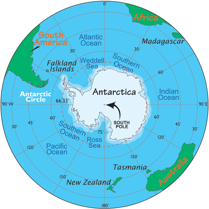
On the map shown, and for that matter on all other maps, the Arctic Circle, Antarctic Circle, Equator, Prime Meridian, Tropic of Cancer and Tropic of Capricorn are imaginary lines.
Tropic of Cancer
A line of latitude located at 23°30′ north of theequator. The Sun is directly overhead the Tropic of Cancer on the summer solsticein the Northern Hemisphere (June 20 or 21). It marks the northernmost point ofthe tropics, which falls between the Tropic of Cancer and the Tropic ofCapricorn.
Tropic of Capricorn
A line of latitude located at 23°30′ south. The Sun is
directly overhead the Tropic of Capricorn on the summer solstice in the
Southern Hemisphere (Dec. 20 or 21). It marks the southernmost point of the
tropics.
Arctic Circle
A line of latitude located at 66°30′ north, delineatingthe Northern Frigid Zone of the Earth.
The Antarctic (or Antarctica) Circle is one of the five major circles or parallels of latitude that mark maps of the Earth. The length of continuous day or night increases southward from the Antarctic Circle, mounting to six months at the South Pole.
Globe
The most accurate map of the Earth, duplicating its spherical shape and relative size.
Point at which the earth turns; the north and south poles
illustrate the axis on which the earth rotates.
Map
Representation of a physical plane withselective information. Maps represent a definite area and contain detailedgeographical information.
Atlas
Combination of maps and charts. An atlas usually includes
geographical information, as well as varied non-geographical information
(population statistics, sea levels, etc.) about a particular location.
Compass
A directional device that is made of a magnetic needle
that synchronizes with the north and south poles.
Climate maps
Give general information about the climate and
precipitation (rain and snow) of a region. Cartographers, or mapmakers, use
colors to show different climate or precipitation zones.
Economic or Resource Maps
Feature the type of natural resources or economic
activity that dominates an area. Cartographers use symbols to show the
locations of natural resources or economic activities. For example, oranges on
a map of Florida tell you that oranges are grown there.
Physical Maps
Illustrate the physical features of an area, such as the
mountains, rivers and lakes. The water is usually shown in blue. Colors are
used to show relief-differences in land elevations. Green is typically used at
lower elevations, and orange or brown indicate higher elevations.
Political maps
Do not show physical features. Instead, they indicate
state and national boundaries and capital and major cities. A capital city is
usually marked with a star within a circle.
Road maps
Show major-some minor highways-and roads, airports,
railroad tracks, cities and other points of interest in an area. People use
road maps to plan trips and for driving directions.
Topographic maps
Include contour lines to show the shape and elevation ofan area. Lines that are close together indicate steep terrain, and lines thatare far apart indicate flat terrain.
Map projections
Two-dimensional representations of the three-dimensional
Earth. Because projections attempt to present the spherical Earth on a flat
plane, they inevitably produce distortions. Map projections are numerous and
complex (e.g., there are a variety of cylindrical, conic, or azimuthal
projections). Each projection has advantages and serves different purposes, and
each produces different types of distortions in direction, distance, shape, and
relative size of areas. One of the most famous projections is the Mercator,
created by Geradus Mercator in 1569. It is a rectangular-shaped map in which
all longitude and latitude lines are parallel and intersect at right angles (on
a globe, meridians are not parallel, but grow narrower, eventually converging
at the poles). Near the equator, the scale of the Mercator is accurate, but the
farther one moves toward the poles, the greater the distortion—Antarctica in
the far south and Greenland in the far north, for example, appear gigantic. The
Mercator projection was used well into the 20th century, but has now been
superseded by others, including the widely used Robinson projection. The
Robinson projection is an elliptical-shaped map with a flat top and bottom.
Developed in 1963 by Arthur H. Robinson, it is an orthophanic (“right
appearing”) projection, which attempts to reflect the spherical appearance of
the Earth. The meridians, for example, are curved arcs, which gives the flat
map a three-dimensional appearance. But to convey the likeness of a curved,
three-dimensional globe, the Robinson projection must in fact distort shape,
area, scale, and distance. The Albers, Lambert, Mollweide, and Winkel Tripel
are some of the other commonly used map projections.
World Atlas. (2016, April 26). Circles of Latitude & Longitude – The Equator, The Prime Meridian, The Tropic of Cancer and Capricorn. Retrieved November 25, 2018, from https://www.worldatlas.com/aatlas/imagee.htm


